No CrossRef data available.
Published online by Cambridge University Press: 09 November 2011

22 RCHME NAR Number SE 52 NE 6.
23 The authors are grateful to Dilwyn Jones for pointing out the site from the air at a time when it could not be photographed, to Philip Sinton for the final drawing, to the farmer, Mr Longbottom, for allowing access and to colleagues for discussions on the nature of the site.
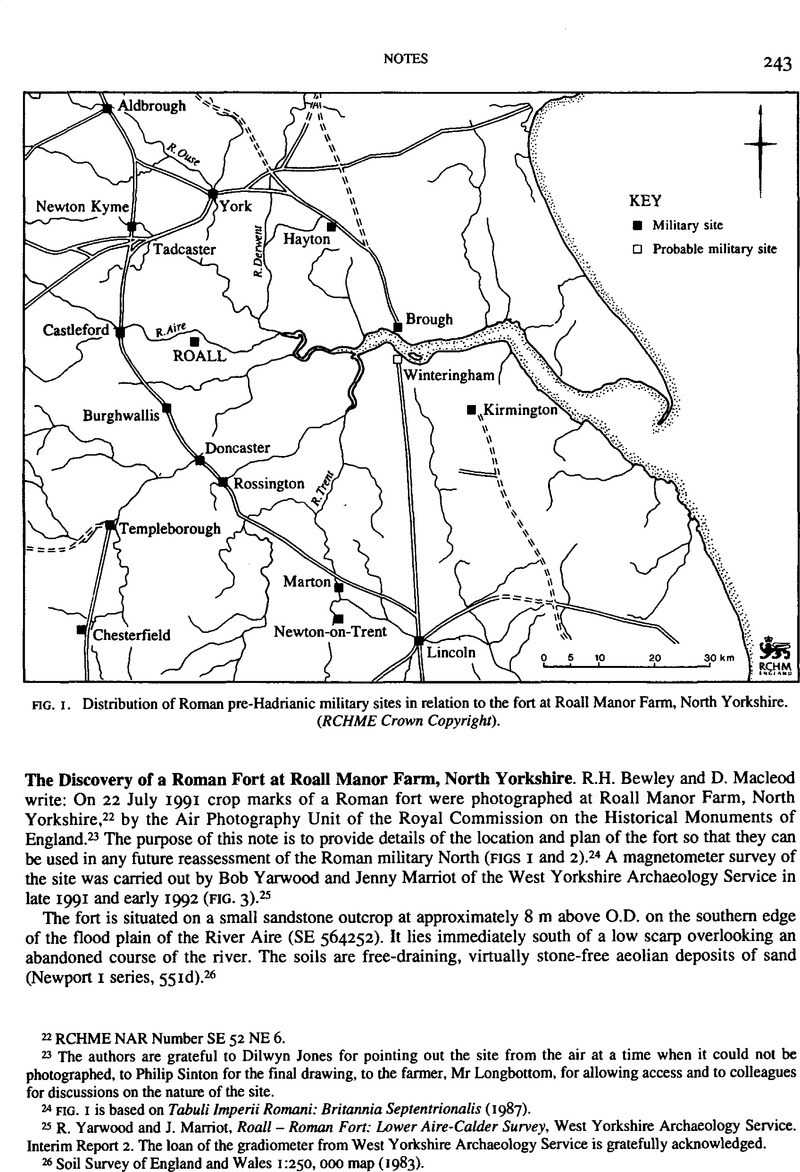
24 FIG. I is based on Tabuli Imperil Romani: Britannia Septentrionalis (1987).
25 Yarwood, R. and Marriot, J., Roall – Roman Fort: Lower Alre-Calder Survey, West Yorkshire Archaeology Service.Google Scholar Interim Report 2. The loan of the gradiometer from West Yorkshire Archaeology Service is gratefully acknowledged.
26 Soil Survey of England and Wales 1:250,000 map (1983).
27 B. Vyner, pers. comm.
28 W. Hanson and G. Maxwell, Rome's North-West Frontier: The Antonine Wall (1983), 2–3.
29 R.G. Collingwood and L.A. Richmond, The Archaeology of Roman Britain (1969), 26–7.
30 Maxwell, G.S., pers, comm.; cf. Britannia xviii (1987), 17.Google Scholar