The origin of social complexity and its connection to monumental buildings in the Andes have long been debated (Burger and Rosenswig Reference Burger and Rosenswig2012; Isbell and Silverman Reference Isbell, Silverman, Isbell and Silverman2002). Indeed, the connection between monumental architecture and early complex societies—in particular, agro-maritime economies in the coastal area of Peru—has been the subject of academic research for more than 20 years (for a review, see Reindel and Hermann Reference Reindel, Hermann, Meller, Detlef and Risch2018).
Since the Archaic period (7000–3000 BC), the Ancash highlands have offered favorable environmental conditions for human settlement; evidence of the oldest (6000 BC) cultivated vegetal species and textile fragments on the continent were found inside the Guitarrero Cave in Callejón de Huaylas near Caraz (Jolie et al. Reference Jolie, Lynch, Geib and Adovasio2011; Lynch Reference Lynch1980). In the southern section of the same region, Quiñones (Reference Quiñones2016) recorded Middle and Final Archaic stone-age–like architecture (e.g., Ragra; Quiñones Reference Quiñones2016:27). In addition to Huaricoto, which was excavated nearly 40 years ago (Burger and Salazar-Burger Reference Burger, Salazar-Burger and Donnan1985), early architecture has been recently studied in different sites of the region, including Kareycoto, Acshipucoto (Munro Reference Munro2018), and Perolcoto (Bria Reference Bria2017). These sites have shared characteristics linked to variations of the same ideology, with common rituals organized around the Mito/Kotosh religious tradition (Bonnier Reference Bonnier, Bonnier and Bischof1997). Whether Tumshukayko belongs to this tradition is one of the main questions motivating our research.
In 2021, drawing from these observations, we began a long-term project to investigate the Initial Formative period (2500–1500 BC) monumentality in the northern-central Andes. We focused on the site of Tumshukayko (Caraz, Ancash; Figure 1) because of its monumental size and its central and elevated location within the Callejón de Huaylas. The team completed an initial survey in 2021, followed by preliminary excavations in 2022.
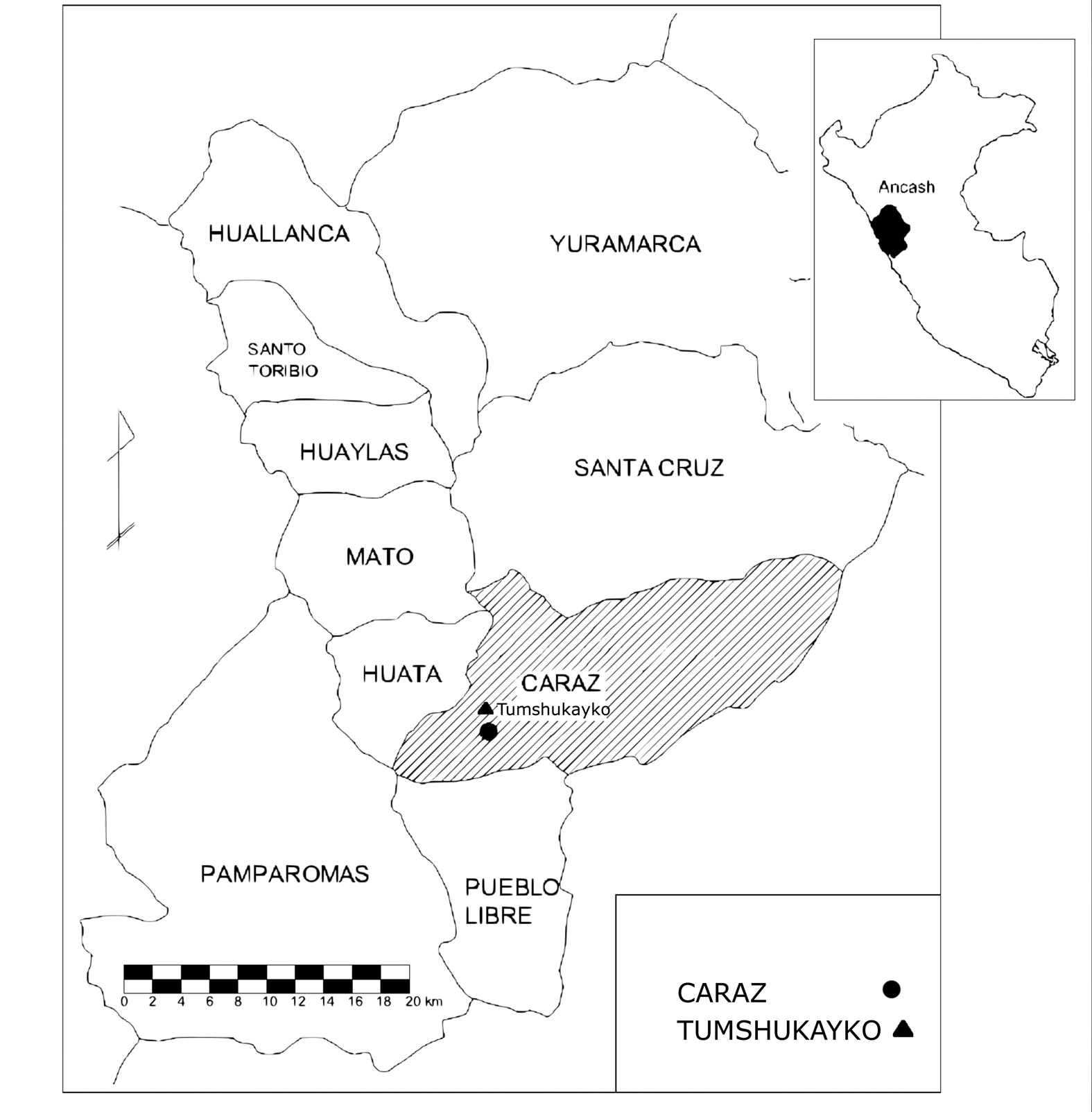
Figure 1. Location of Tumshukayko in the Caraz Province (Ancash Department, Peru).
The archaeological site was traditionally identified as an artificial mound, Tumshukayko A, located 1 km from the town of Caraz (2,250 m asl). However, several oral testimonies and aerial photographs taken in 1948, when the urban area of Caraz was reduced, suggested that the original site covered a larger surface, including other mounds, such as Tumshukayko B. The objective of the first two field campaigns was to understand and map the actual size of the archaeological area.
Limited excavations at the site were conducted by Valladolid (Reference Valladolid1990). Alberto Bueno (Reference Bueno2003, Reference Bueno2005) worked most extensively, but his results remained largely unpublished, and the artifacts were unstudied. The current conformation of Tumshukayko is the result of excavations carried out by the local population at the urging of Mariano Araya, an amateur who had previously worked with Valladolid, for the purpose of uncovering architectural features to make the site a tourist attraction. This operation compromised the stratigraphic sequence in some areas of the site, and the accumulation of backdirt made it very difficult to interpret the structures in the lower parts of the mound. The materials from Araya's excavations are held in the local Hernán Osorio Herrera Municipal Museum.
The Monumental Archaeological Area and the Excavations
Tumshukayko A
Tumshukayko A has a visible extension of 3 ha and a height of approximately 50 m. It comprises various artificial platforms (Figure 2) constructed by accumulating stones and earth that are retained by monumental single-revetment walls that serve as platform faces or revetment walls. In some cases, these revetment walls are very close to each other, as are the so-called chakana walls (nos. 11 and 12 in Figure 2) in the northern part of Mound A (Figure 3). Many other features—including funerary and domestic architecture, ramps, and stairways to connect the various spaces and levels—were built on the platforms mainly from the Initial Formative period to modernity.
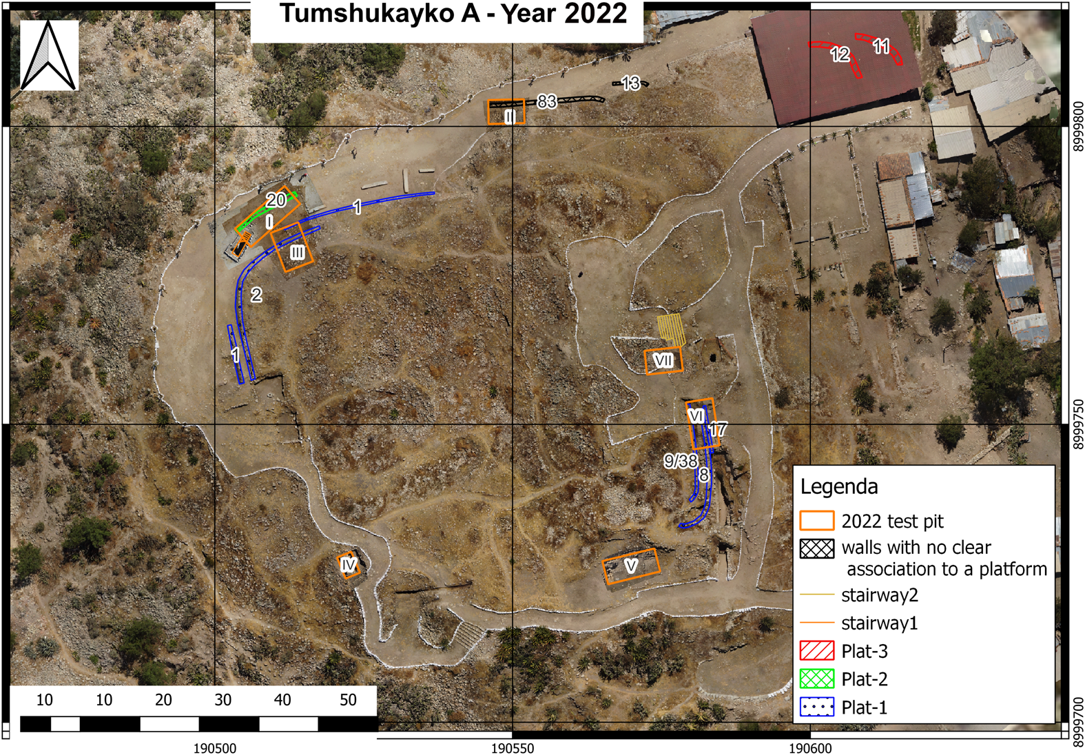
Figure 2. Orthophoto of Tumshukayko A with the structures mentioned in the text and the location of the test pits.
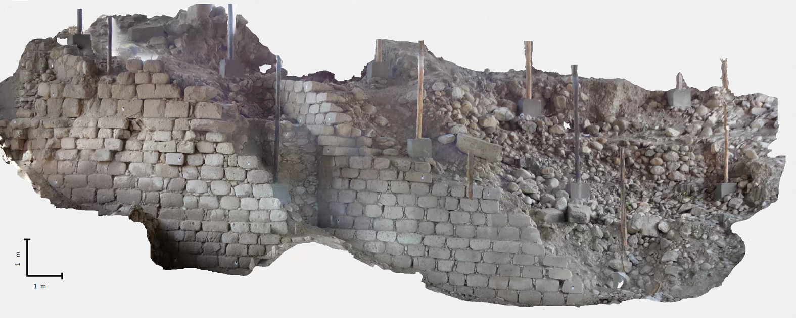
Figure 3. Orthophoto of revetment walls 11 and 12 in the northern sector of Tumshukayko A. (Color online)
Previous studies (Querevalú Reference Querevalú2014) and our 2021–2022 fieldwork identified more than 20 possible platform faces. In this section, we describe only those relevant to the mound construction process.
All the earlier mentioned structures are visible at present and are identified with a number. To better understand the ancient morphology of the site and the relationship between its structures, we dug seven test pits in Sector A (Figure 2).
Excavations revealed that, in an initial stage of mound construction, platform face 2 was probably built together with platform face 20: thus, they were faces of two overlapping platforms. At a later stage, platform face 1 was erected very close to platform face 2 (Figure 4), probably to modify the preexisting platform (Figure 5). In the flat space between structures 1, 2, and 20 is a stairway that leads to a lower platform that is not visible in the current morphology of the site (Figure 6).

Figure 4. Orthophoto of revetment wall 2 in the northern sector of Tumshukayko A. On the left side, revetment wall 1 stands immediately in front of wall 2, partially covering the façade. (Color online)
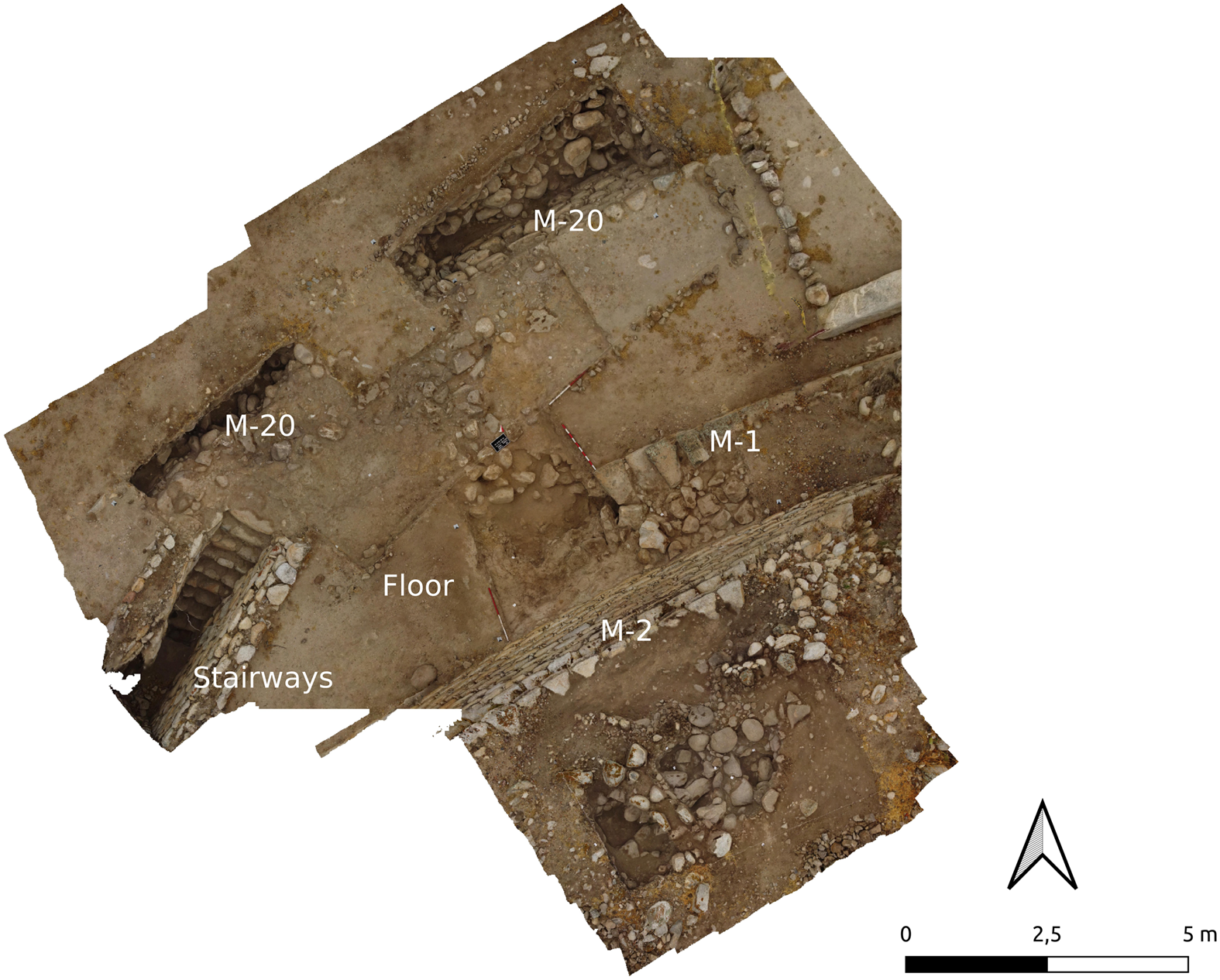
Figure 5. Test pit III with structures 1, 2, and 20 (M-1, M-2, and M-20 in the figure). Note the stairway, which leads to a lower platform that has not yet been excavated. (Color online)
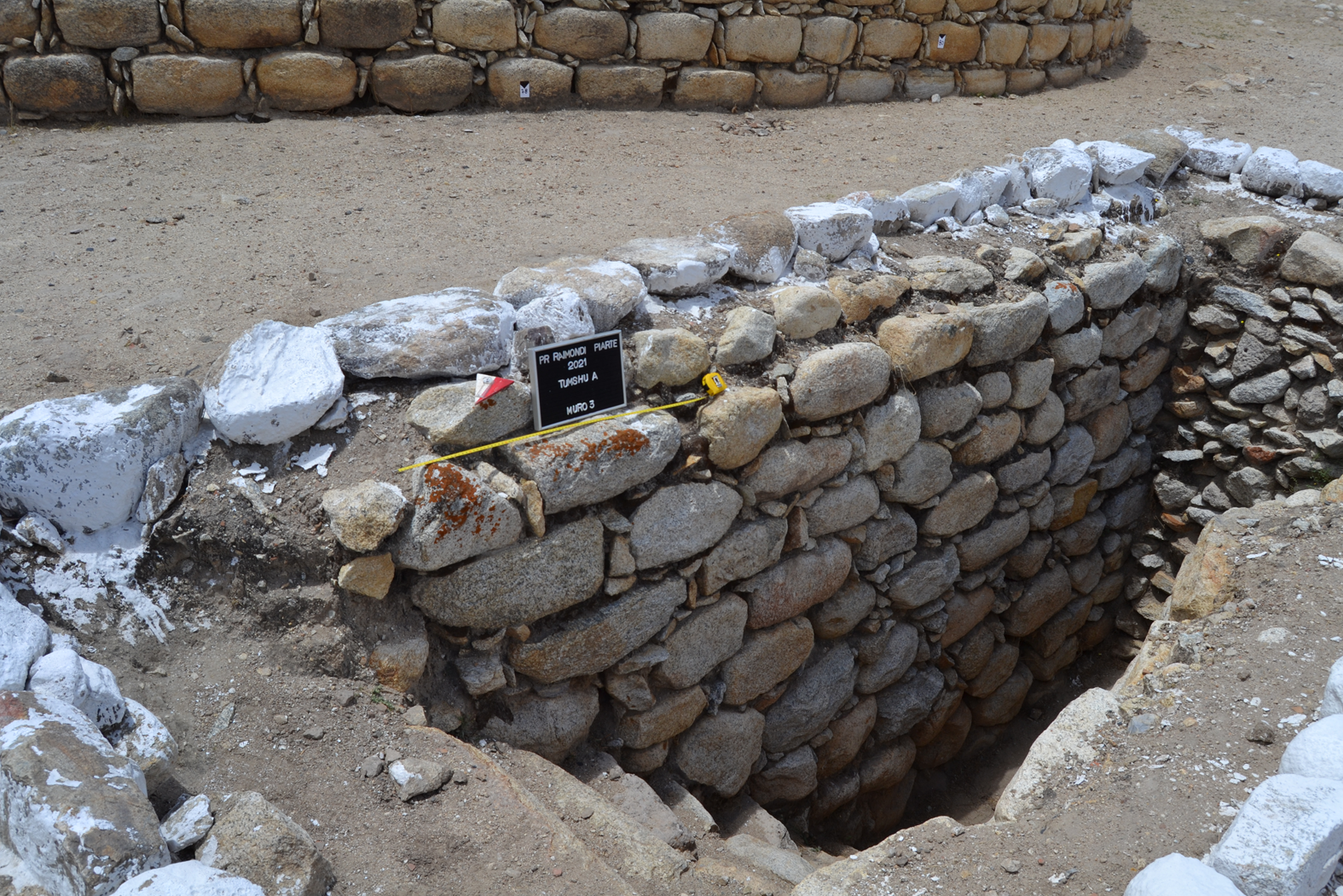
Figure 6. Stairways in Tumshukayko A. (Color online)
In the area near platform faces 1 and 2, a test pit revealed a previously unknown platform face, which was registered as no. 83. Near this one is also preserved platform face 13. These two platform faces are parallel and are very near platform revetment walls (see Figure 2), like the others observed at the site, but their function and relative chronology must be further investigated.
In test pit VII, dug in the central part of Tumshukayko A, we identified another revetment wall, no. 38 (Figures 2 and 7). In addition, we found a superimposition of platform faces very close to one another—nos. 8, 9, 17, and 38 itself—which we observed could be a characteristic feature of the Initial Formative period architecture of the site.
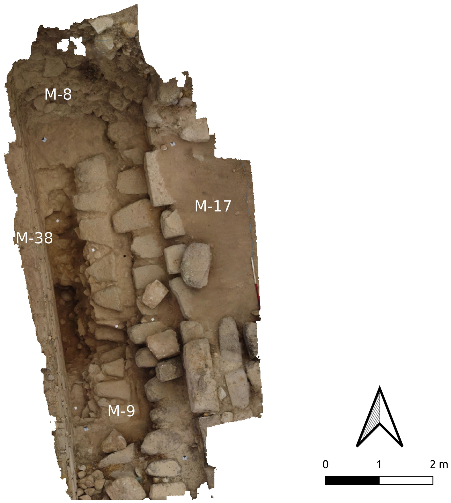
Figure 7. Test pit VII revealed a sequence of monumental revetment walls (M-38, M-8, M-9, and M-17 in the figure) placed very close to one another. (Color online)
Finally, in this same area, there is a monumental staircase (Stairway 2 in Figure 2) facing east, leading to the highest platform of the mound. We discovered that its lowest portion had been covered at a later stage to limit access to the upper platform.
During the excavations, we recovered large quantities of ceramic artifacts dating from the Late Formative period (800–400 BC) to modernity (Figure 8). Intriguingly, in some contexts, such as in test pits I, II, and VII, ceramics were absent, but stone and bone objects were present. Since this is characteristic of Initial Formative period cultural contexts (3000–1500 BC), we argue that layers without ceramics could belong to this preceramic phase of the mound.
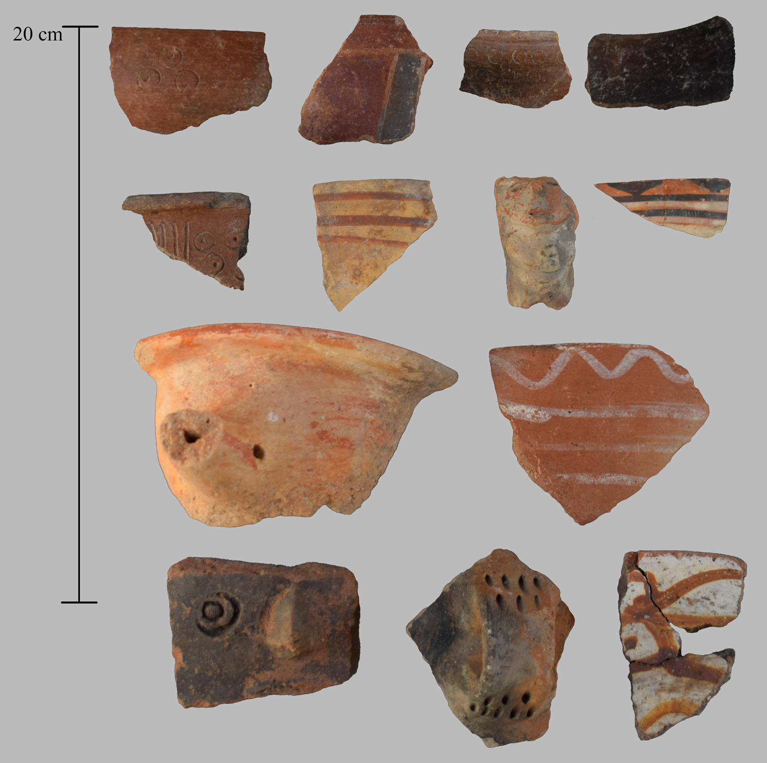
Figure 8. A sample of ceramics of different epochs and styles from Tumshukayko A.
Tumshukayko B
On the southern side of Tumshukayko A, we identified a smaller mound, Tumshukayko B, which measured approximately 2,500 m2 with a height of 5 m; it was covered by thick vegetation (Figure 9). The only visible architectural remain was a poorly preserved revetment wall (no. 102 in Figure 8) that supported the upper portion of the mound.
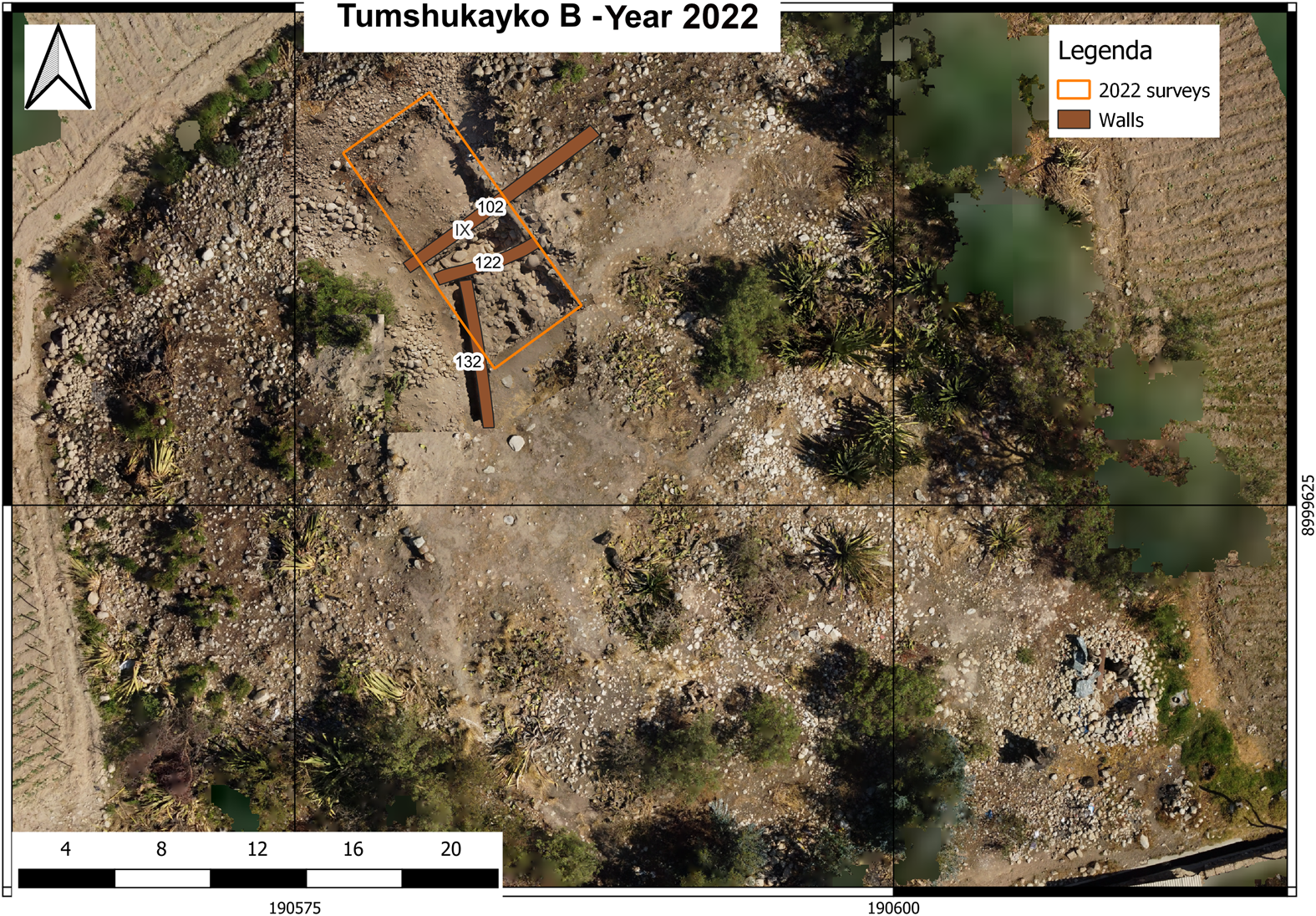
Figure 9. Orthophoto of Tumshukayko B with the structures mentioned in the text and the location of the test pit. (Color online)
Whereas the tests pits conducted in Mound A had the aim of determining the correlations between the architectural features and morphology of the site, in this case, the object of the investigation was to determine the features of the mound.
A 10 × 5 m trench was dug to understand its various construction phases, chronology, and relationship to Tumshukayko A. Excavations revealed that Mound B might have been shaped as a truncated pyramid in its final phase and that it might have developed over at least two artificial platforms, with revetment walls made of irregular stones and fluvial pebbles bound by fine-grained mortar. Both platforms were oriented along an east‒west direction (Figure 9). The upper one, defined by platform face 102, was connected to a partially conserved floor of clay-like yellowy earth. Beneath this level, we discovered another large platform that had been built with a similar technique and almost the same orientation as the other: its platform face wall (no. 122 in Figure 10) was conserved for a height of 2 m and was connected to a lower floor (the second level of the platform).
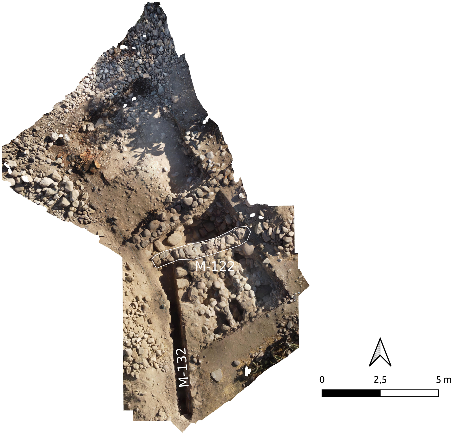
Figure 10. Close view of test pit IX in Tumshukayko B. Note revetment walls 132 and 122 (M-132 and M-122 in the figure). (Color online)
We retrieved large quantities of ceramic artifacts dating to diverse periods but mainly from the Late Formative (800–400 BC) and Early Intermediate (AD 0–600) periods. Fragments in the upper layers belong to later periods—from the Middle Horizon (AD 600–1000) to the colonial era.
Below these ceramic layers, another revetment wall was found (no. 132) that featured a different orientation—north‒south—associated with a floor that probably defined another level of the platform. Its construction was similar to that of the Tumshukayko A artificial platform faces, although the stones were less smooth and seemed unfinished. It was partially dismantled to construct platform face 122. This level had no ceramics and was associated with subcircular structures with remains of bones, currently under study (Figure 9); it was constructed with stones and pebbles in the fill of the artificial embankment of the platform. Due to the resemblance with the Mound A main structures described earlier, we suggest that this platform level, whose construction technique strongly differs from that of the upper levels, may have been built during the Initial Formative period.
Discussion
Tumshukayko has long been identified with the mound that we defined as Sector A, and thus far, the size of the monumental complex and of the mound itself has neither been extensively studied nor debated. The several studies conducted of Tumshukayko A have focused on bringing to light its structures, without an effort to better understand what reason or purpose undergirded the overall construction. We were interested in determining the layout of the mound because it is crucial to understanding the monumentality and social complexity at the site. To accomplish this goal, our test pits focused on identifying the physical relationships among the visible remains, identifying new ones, and setting them within a general layout (Figure 2).
This focus would allow us to obtain further knowledge about the original volumetry of Mound A and the diachronic development of the platforms that comprised it. Furthermore, we wanted to understand the possible connections between the different architectural features (especially the revetment walls) that had similar construction techniques and were located on the same level: this analysis is helping us determine a layout of some portions of the site, which no longer appear “disconnected” from one another but take on a shared meaning.
Although this work has just begun, increasing data support our hypotheses on the number and layout of platforms comprising the main pyramid-shaped mound. Based on the data obtained during our first excavation campaign, we propose the following:
• The northern part of Sector A may have had at least three platforms (Figure 2). From top to bottom, revetment walls 1 and 2 would form platform 1, the highest one, whereas revetment wall 20 was the only one identified for platform 2. Revetment walls 11 and 12 would make up platform 3, which is actually the lowest platform. Revetment walls 13 and 83 are not yet firmly associated with a specific platform.
• Stairway 1 connects platforms 2 and 3.
• In the southeast part of the higher platform of Mound A, we found four revetment walls (nos. 8, 9, 17 and 38) built very close to each other. However, in the northwestern corner, there are apparently only two platform faces, 1 and 2. We need to further investigate the reason for this discrepancy. Was there more remodeling along the east facade compared to the west? Are there traces of further modifications in the west sector that have not been identified yet?
• Stairway 2 would have been the main access to the upper platform and probably to the entire complex, which was oriented to the east toward the glacier peeks. This might be why it was subject to several remodeling actions. The presence of the stairway could be related to the apparently different forms of remodeling that occurred in the eastern and western facades.
Excavations at Tumshukayko B revealed the presence of at least one artificial platform like those found in the monumental area of Tumshukayko A. This allowed us to determine that this mound could have had a phase contemporary with the Initial Formative period phase at Tumshukayko A.
With the data available as of now, we can imagine that at the time of its construction, Tumshukayko was a large complex consisting of a main eastward-facing mound made of superimposed platforms. It was probably surrounded by several smaller mounds.
Our studies allowed us to deepen the knowledge of this monumental complex and highlighted the most important issues that we must investigate in the future.
Acknowledgments
Thanks to the Asociación Vecinos de Tumshukayko, Asociación Caraz Cultura, and Dr. Claudia Fredella. The fieldwork was conducted with permits from the Ministerio de Cultura del Perú (Resolución Directoral no. 250-2021 and no. 205-2022).
Funding Statement
Funding was provided by the Ministero degli Affari Esteri e della Cooperazione Internazionale, the Museo delle Culture of Milan, and the Università IULM di Milan. The Caraz Municipality financed the salary of the excavation assistants.
Data Availability Statement
Georeferenced orthophotos of the sites are stored at the Università di Modena e Reggio Emilia in Modena, Italy.
Competing Interests
The authors declare none.


